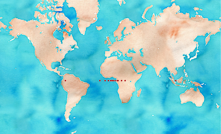
Ok, I misunderstood… . The Null Island Archipelago is actually meant to be just datum based, i.e. not the 0,0 of every projection, but the 0,0 of every null lat/lon.
CREATE OR REPLACE FUNCTION where_in_the_null (crs integer) RETURNS
geometry AS $$

WITH null_island AS (
	SELECT ST_MakePoint(0,0) AS geom
	),
null_island_crs AS (
	SELECT ST_SetSRID(geom, crs) AS geom FROM null_island
)
SELECT ST_Transform(geom, 4326) FROM null_island_crs

---

DROP TABLE IF EXISTS null_archipelago;

CREATE TABLE null_archipelago AS
SELECT srid, where_in_the_null(auth_srid) FROM spatial_ref_sys
WHERE proj4text LIKE '%longlat%';
@mizmay Someone suggested & @schuyler tweeted (who? please remind me!) a few weeks ago that each coordinate reference system (CRS) has it’s own Null Island, and therefore there must be a Null Archipelago. This got me thinking — what does that look like?
Enter PostGIS. We’ll create a function, that given an EPSG code will return the 0,0 location for that reference system in the real world. It turns out, this is quite easy.
So, now we need some EPSG codes. To that end, we have one in any PostGIS database.
Map tiles by Stamen Design, under CC BY 3.0. Data by OpenStreetMap, under CC BY SA.


One thought on “Null Archipelago — Null Islands for All Coordinate Reference Systems — revision”