In my earlier post, I made a claim that SFCGAL was used in this figure:
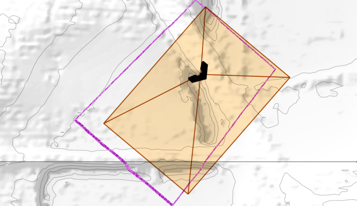
It dawned on my afterwards, while I was using 3D, I hadn’t actually employed any of the analysis goodies that come with SFCGAL. Well, here it is– a footprint as calculated using the view angles and a real terrain model:
Here it is compared with the initial calculation:


Hello! Great book! I got the print and eBook versions. It was exactly what I was looking for and the timing could not have been better.
I am still waiting for access to the dataset from Packt though…
If one was interested in the 3D GPS coordinates of the four corners of intersection with the surface instead of the full boundary, what would be the best approach?
I had already been considering using a ray frame similar to your solid pyramid and had a similar RotateXYZ worked up, but can’t figure out how to get the intersection with the corner rays.
Instead of extruding the surface, I was considering volumizing the rays so your approach has triggered all sorts of new options. Thanks!
After extruding the surface, is it possible to get the intersection points of the corner rays with PostGIS?
Thanks. Love the book.
I suppose if all you want is the intersecting corner points, you just intersect a ray (or your 4 rays) with the DTM– no need for extrusion. I think that would give the result you seek (although I haven’t tested). That’s an elegant way to do it. That said, we are very near the edge of what 3D PostGIS can do at the moment, so beware dragons. That’s why I stuck to volumetric intersections with TINs– really the only guaranteed intersections until Oslandia finishes their work for PostGIS 2.2.
I’m sorry to hear Packt hasn’t posted the data yet. You can get chapter 2, 4, 6, and 7 (unofficially) in the following github repo.
https://github.com/smathermather/postgis-cookbook-data
Hmm, re-reading, I’m not sure if you can get those points just now. Volumizing your rays would work, so long as you make them TINs, though.